
Once again this year, students of Applied Informatics and Geoinformatics and Surveying at Mainz University of Applied Sciences attended the annual FOSSGIS conference. Participants from various disciplines met in Hamburg on the campus of the Hamburg University of Technology (TUHH) to discuss and explore the latest developments, technologies, and applications in the field of free and open geoinformation. From March 20 to 22, participants had the opportunity to gather a wealth of impressions during presentations and workshops. Sarah Schütz, Elena Zentgraf, and Johannes Frank from the consecutive Master’s degree program in Geoinformatics and Surveying presented the results of their teaching research projects from the Geo-Government 2 module taught by Prof. Dr. Pascal Neis.
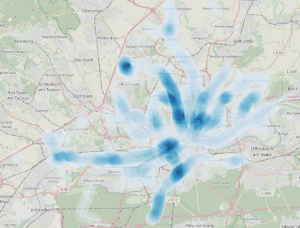
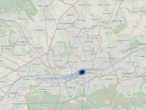
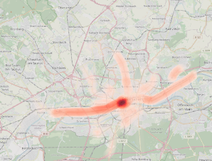
Results of the line-density analysis of the spatial police reports of a crime (Map: OpenStreetMap): Heat map of property damage (top left) and heat map of violent offenses (top right), heat map of drug offenses (bottom left), heat map of robbery offenses (bottom right)
In his presentation, Johannes Frank presented the results of his research project Analysis and visualization of police reports. In this project, he examined publicly available press releases from the Frankfurt am Main police headquarters. In his talk, he explained the process steps that were necessary to derive precise spatial data from the text-based information on crimes committed. He also presented approaches to automating the sorting of police reports into crime categories. The results of his work can be visualized in a dashboard. In keeping with the FOSSGIS motto, the focus of the work was on the use of open-source solutions and open standards.
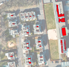
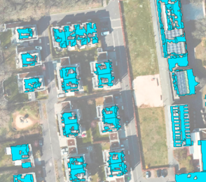
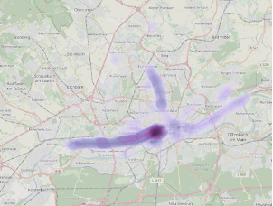
Comparison of installed PV systems (left) and available potential areas (right), graphic: Elena Zentgraf, Sarah Schütz; CC BY SA 4.0
In their presentation, Elena Zentgraf and Sarah Schütz presented a methodology to identify the proportion of fully exploited solar potential and valuable open spaces on rooftops in a district of Mainz as a test area.
Using open data and open-source tools, the current situation was analyzed, taking into account important factors, and a basis for action for future solar system installations was developed. The opportunities offered by an analysis of solar potential underline the importance of solar energy as a driving force in Germany’s energy transition. This prototype approach demonstrated how geoinformatics and open-source software can help drive the energy transition and pave the way to a climate-neutral society.
Written by Johannes Frank, Sarah Schütz and Elena Zentgraf


