Bachelor of Science in Geoinformatics and Surveying
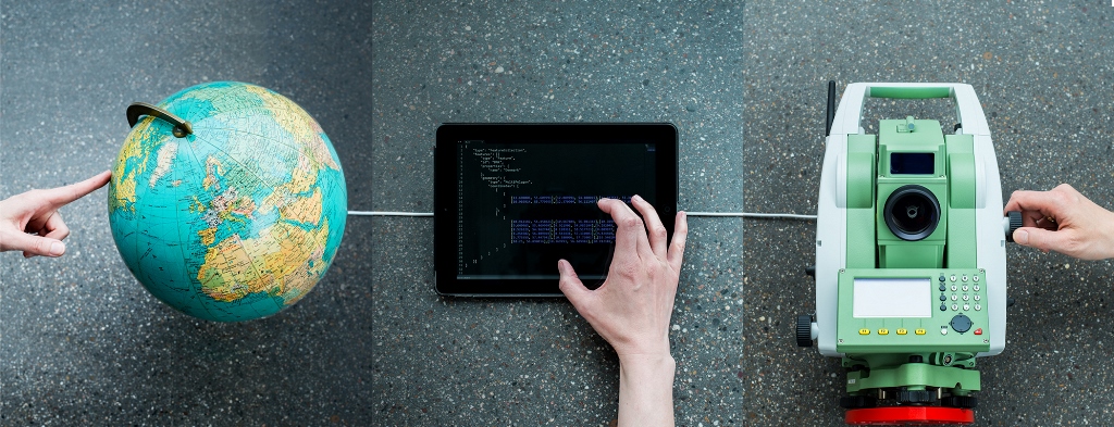
What do Galilei, Google Earth, navigation systems and Pokémon GO have in common? They all work with the geodetic spatial reference.
You will learn what this means and how it works while earning your bachelor's degree in geoinformatics and surveying. The degree program covers the use of various measuring methods such as tachymetry, GPS, photogrammetry or remote sensing. You will also deal with the processing and analysis of the data obtained in this way, for example using modern geoinformation systems (GIS).
As an engineer for geoinformatics and surveying, you are skilled in the precise surveying of buildings and objects as well as software and app development, usage of databases and computer-aided construction of maps and plans. You can also use your knowledge in regional soil management.
What's in Store for you
You will complete a twelve-week pre-study internship before the start of your studies, at the latest, however, by the time you re-register for the 4th semester. This is not necessary if you have already completed a related training, for example as a surveying technician or geomatist.
You can do the pre-study internship at public offices and private companies, provided that qualified training in geoinformatics or surveying under the supervision of a university graduate is guaranteed. The pre-study internship should give you a balanced overview of the tasks of geoinformatics and surveying.
During the pre-study internship, you will keep an employment diary to document your main activities.
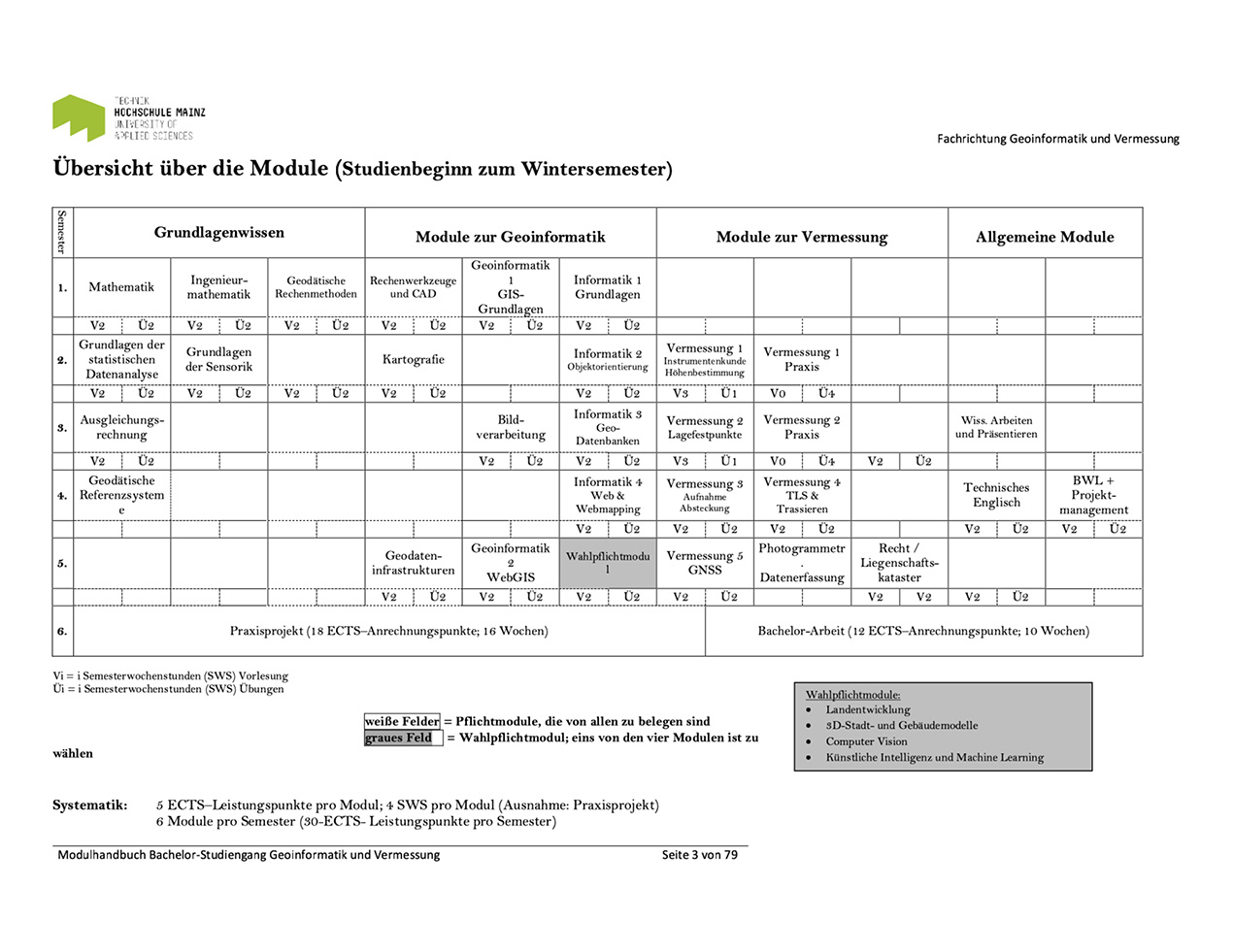
The course is modular in structure. Each module consists of five semester lessons per week with theoretical and practical components, and is awarded six ECTS credits upon successful completion of the course (coursework and exams). With this concept, we guarantee that all our students will be able to acquire sound knowledge in the field of geoinformatics and surveying and that they will be able to study quickly within the standard period of study. At the end of each semester you take an examination for each module. In the 6th semester you complete the 16-week practical project and write your bachelor's thesis within ten weeks.
Registration for module exams
Register online for your module exam (demo). Please check in the HIP whether your registrations or cancellations have been entered correctly and on time.
We recommend that you bring the printed list of your applications along to all module examinations. In case of discrepancies, please contact the examination office in good time.
Project work, bachelor's thesis and grade improvement
It is not possible to register online for project work, bachelor's thesis and grade improvement. Please submit them informally, but in writing and sign them at the examination office. Digital document as an email attachment is also accepted.
Address: School of Engineering, Examination Office, Holzstraße 36 in 55116 Mainz
Email: daniela.held(at)hs-mainz.de
Deadlines
The deadlines for module registrations and cancellations can be found in the general timetable, which you will receive on your first day of study. Later, you can view the dates on the learning platform Olat (Online Learning And Training).
Exam results
The results of your examinations can be accessed via the online service HIP. We recommend that you pick up the corrected exam at the secretary's office of the Department of Geoinformatics and Surveying.
Important information, for example on the incapacity for examinations, can be found on the website of the Examination Office.
In the 6th semester you will complete a 16-week practical project, in addition to which you will write your bachelor thesis within ten weeks, both in cooperation with Mainz University of Applied Sciences and the recruitment office.
In your bachelor's thesis you show that you can write a scientific paper on a topic of geoinformatics and surveying within the given period of ten weeks. In addition to the written version, you create a poster and a website.
In addition to the support in the office, a professor at the university will be available to advise you during the entire time and support you in case of questions and possible problems. She or he will also give you advice in good time before the submission of the paper, as it accounts for 65 percent of the assessment. In addition, you will present the essential content of your work in a 20-minute oral presentation. Here you document your ability to deal with technical topics scientifically and present them in an understandable way. The presentation will be included in the assessment of the thesis at a rate of 25 percent.
You can find specifications and guidelines on formal requirements in the OLAT course virtuelles Geschäftszimmer (virtual business room, only available in German). In the Abschlussarbeitsdatenbank (dissertation database , only available in German) you can find suggestions for possible topics.
Documents on the practical project (only available in German):
Your professional prospects
Career
If you have taken a liking for modern information technology and electronic data processing during your studies, the successful completion of your bachelor's degree makes you a recognised expert for spatial information.
Studying for a master's degree
With the Bachelor of Science (B. Sc.) you can continue your studies in geoinformatics and surveying. Of course, you can also switch directly to the profession. Potential employers include surveying offices, construction companies, utilities and waste disposal companies, suppliers of navigation equipment, manufacturers of surveying instruments, land surveying, cadastral and land consolidation authorities, and soil management and geo-basis information offices.
Students who are thinking about studying abroad can count on our full support. However, we recommend that you do not plan this before the 5th bachelor's semester, as you will have acquired sufficient specialist knowledge by then. If you wish to have your time spent abroad credited towards your studies, make sure that you can earn enough credit points abroad. The examination board will advise you on the selection of modules.
Start planning at least six months before you intend to start studying abroad. We recommend that you first consult a student advisor. You may have to take organizational measures in the curriculum and examination schedule both in Mainz and abroad. It also takes some time to apply for grants.
Important information can also be obtained from the International Office of Mainz University of Applied Sciences.
FranCE
- Ecole Supèrieur des Géomètres et Topographes (E.S.G.T.) du CNAM in Le Mans
- Université de Bourgogne, Laboratoire Electronique Informatique et Image (Le2i) (Labor für Bildverarbeitung und Elektronik) in Dijon
- Laboratoire Hubert Curien, Faculté des Sciences et Techniques, Saint-Etienne
Sweden
- University of Gävle in Gävle (courses in English)
Spain
- Universidad Polytécnica de Valencia, Escuela Técnica Superior de Ingeniería Geodésica, Cartografía y Topografía (E.T.S.I) in Valencia
USA
- University of Nebraska at Omaha, Department of Geography & Geology und College of Information Science & Technology in Omaha, (NE)